

Hiking to Pierce Lakes and the summit of Mt MacFarlene in Chilliwack, BC.
After recently completing the North Coast trail – six days of crushingly hard hiking – I meant to take the weekend off and let my body rest. However, when a hot sun and glorious blue sky greeted me on Saturday morning, what was supposed to be a rest day suddenly became a half day hike. Which then became a full day hike. Which then became literally the biggest hike I have done this year. It seemed a shame to waste the physical conditioning I had just received, and after this weekend’s journey, an 1800 m (5906 feet) climb up Mt MacFarlene, located near the icy Chilliwack Lake in the Fraser Valley, I was happy to note that I didn’t find it as challenging as I thought I would, given the truly brutal elevation gain. Turns out if you spend all your time hiking, you get pretty good at it. A real shocker.
Mt MacFarlene is a stunning peak tucked away in the Chilliwack river valley, part of the Canadian Cascade range. I had heard the name vaguely before, but never thought much about it, as it is inevitably overshadowed by its notorious neighbour, the wickedly sharp and difficult Mt Slesse. Some other classics in the area, namely Lindeman Lake and Mt Cheam, also do their fair share of glory-hogging in the region. While a long and monstrously steep hike, MacFarlene is worth every step. Two wonderfully blue lakes (upper and lower Pierce Lake) await you, plus a waterfall, and the 360 degree view peak. Camping at the lakes is also very popular, as the whole trail can be quite long and tiring as a single day trip.
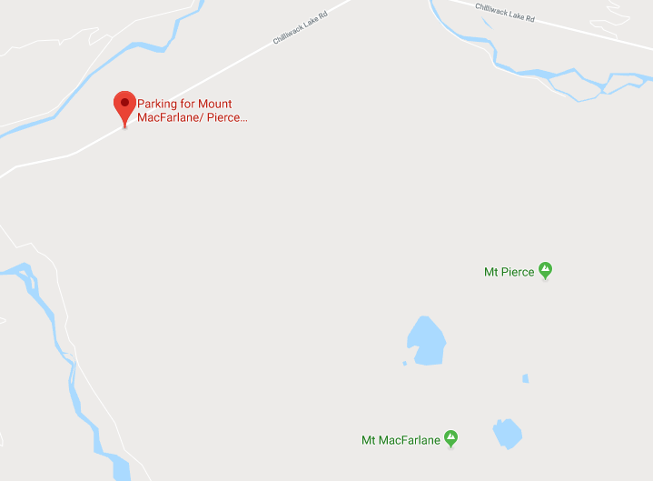
To reach the trailhead for MacFarlene, head down towards Cultus Lake in Chilliwack. At the roundabout before the bridge over the Vedder river, turn left onto Chilliwack Lake road. Follow the road for about 20 minutes. On the right, you’ll eventually see a small sign indicating the parking lot for Pierce Lake. Park here, and begin your trek up the wide gravel road. This logging road continues switch-backing up the mountain for a little while; however, there is a turnoff on the right side of the road shortly after the parking lot which is marked by a wooden sign for Pierce Lake. This is where the trail begins. Don’t, as we did, get extremely distracted talking and completely miss the turn off… We realized our mistake after a few kilometers. Like the prepared (but I guess oblivious) hikers we are, we pulled out our GPS map and found a random, bushwacky connector trail high up the road that connected us to the lake trail without any backtracking. Yay for technology and scratched arms!
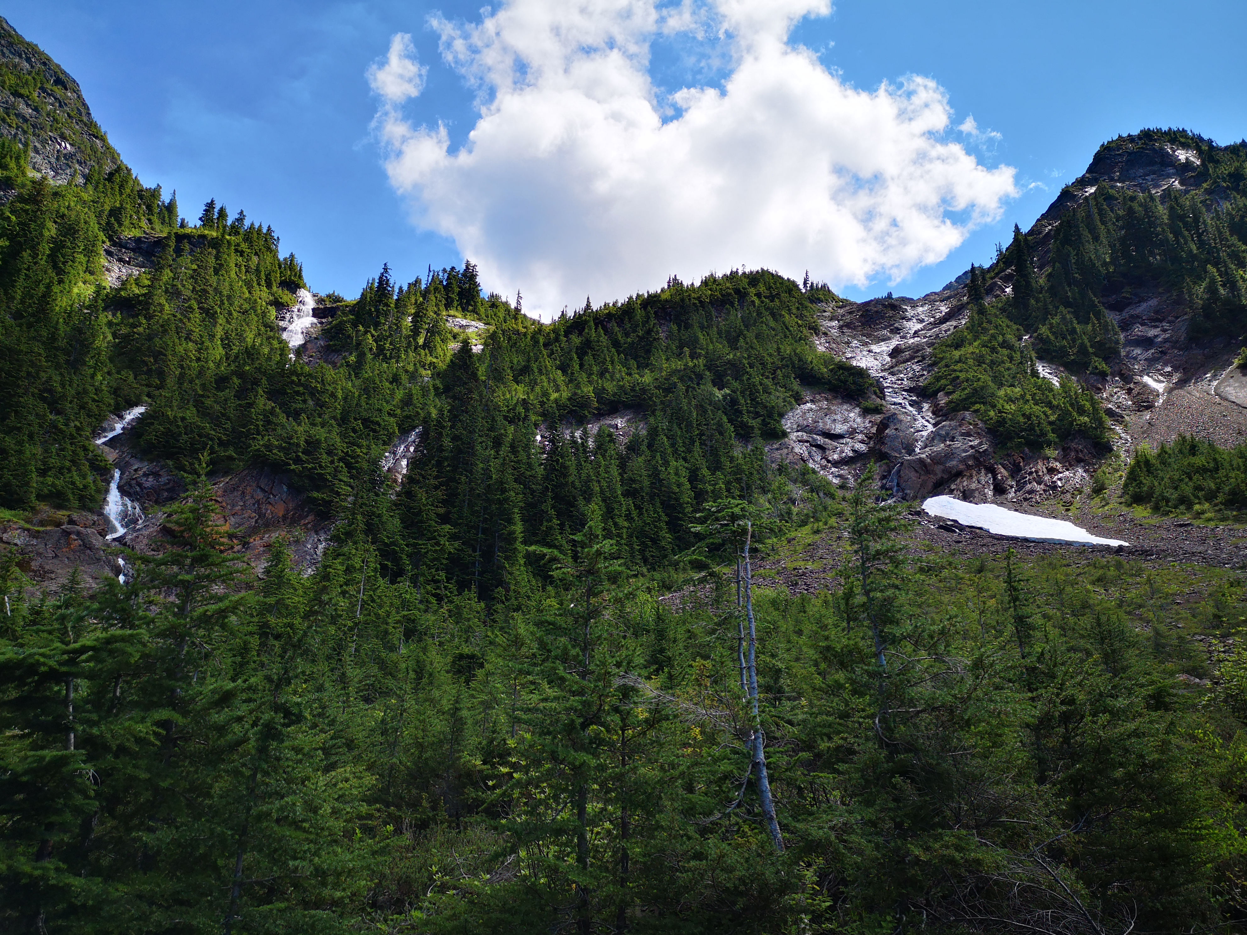
Once we hit the trail in earnest, however, we almost wished we were back on the logging road. Apparently whoever created the bottom portion of this trail did not believe in switchbacks, choosing instead to design a path straight up the mountain. The result of this is pure calf-burning pain. Fortunately, the trail does mellow out as you hike farther on, eventually beginning to switchback, and passing through some blessedly flat rock sections, and even a few downhills for creek crossings.

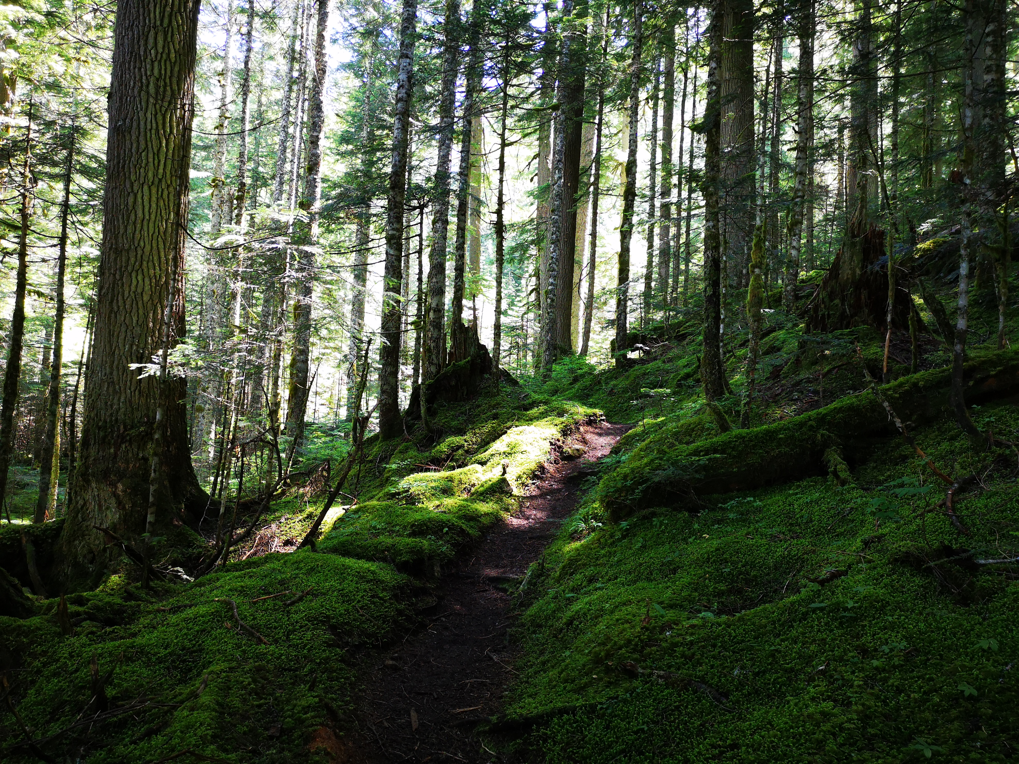
The portion of the trail before Lower Pierce Lake is densely forested, with only one or two breaks in the trees for a view. However, there are sections of fairy-tale-like emerald undergrowth, clear and cold streams, and soft, springy ground (easy on the knees!). While there are a few muddy patches, the trail clearly gets decent maintenance attention, as there are logs/bridges in place to provide a less messy path forward.
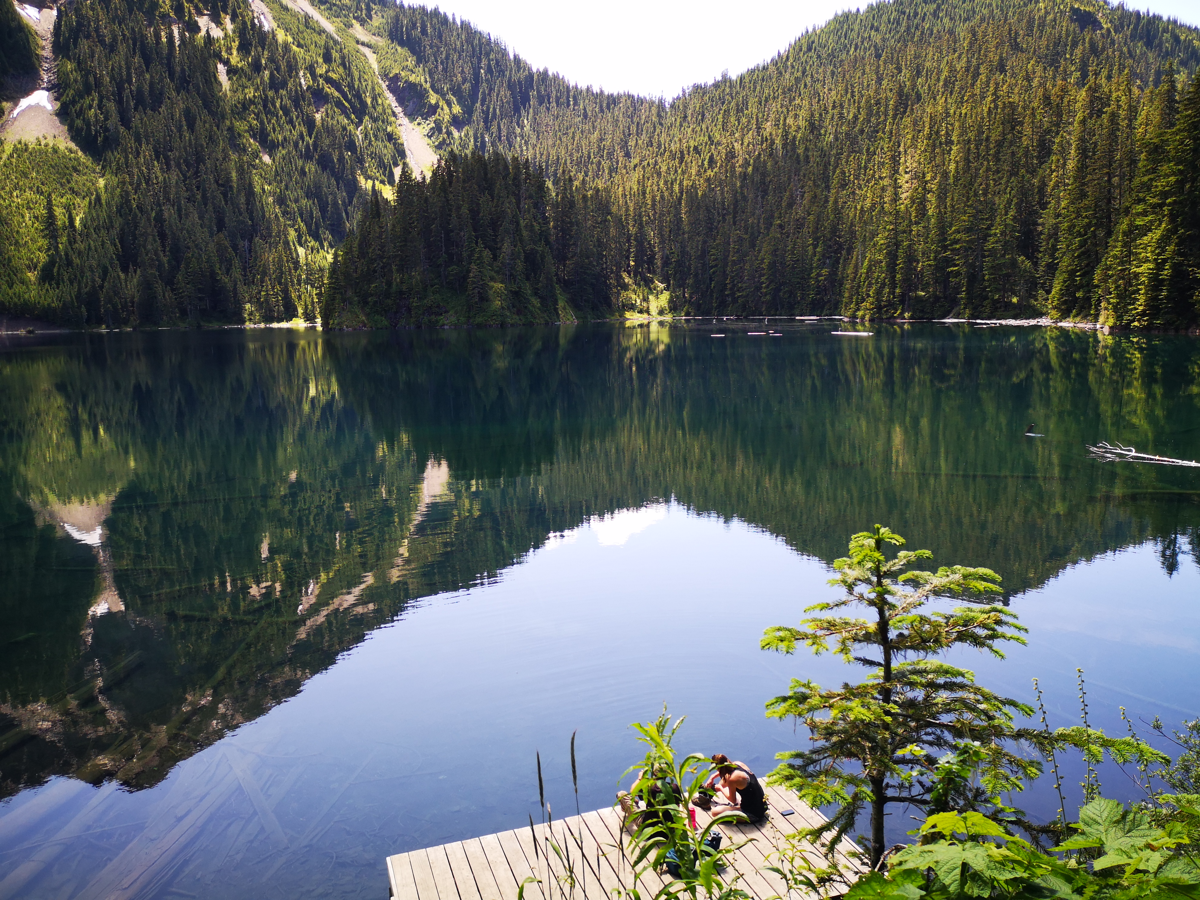
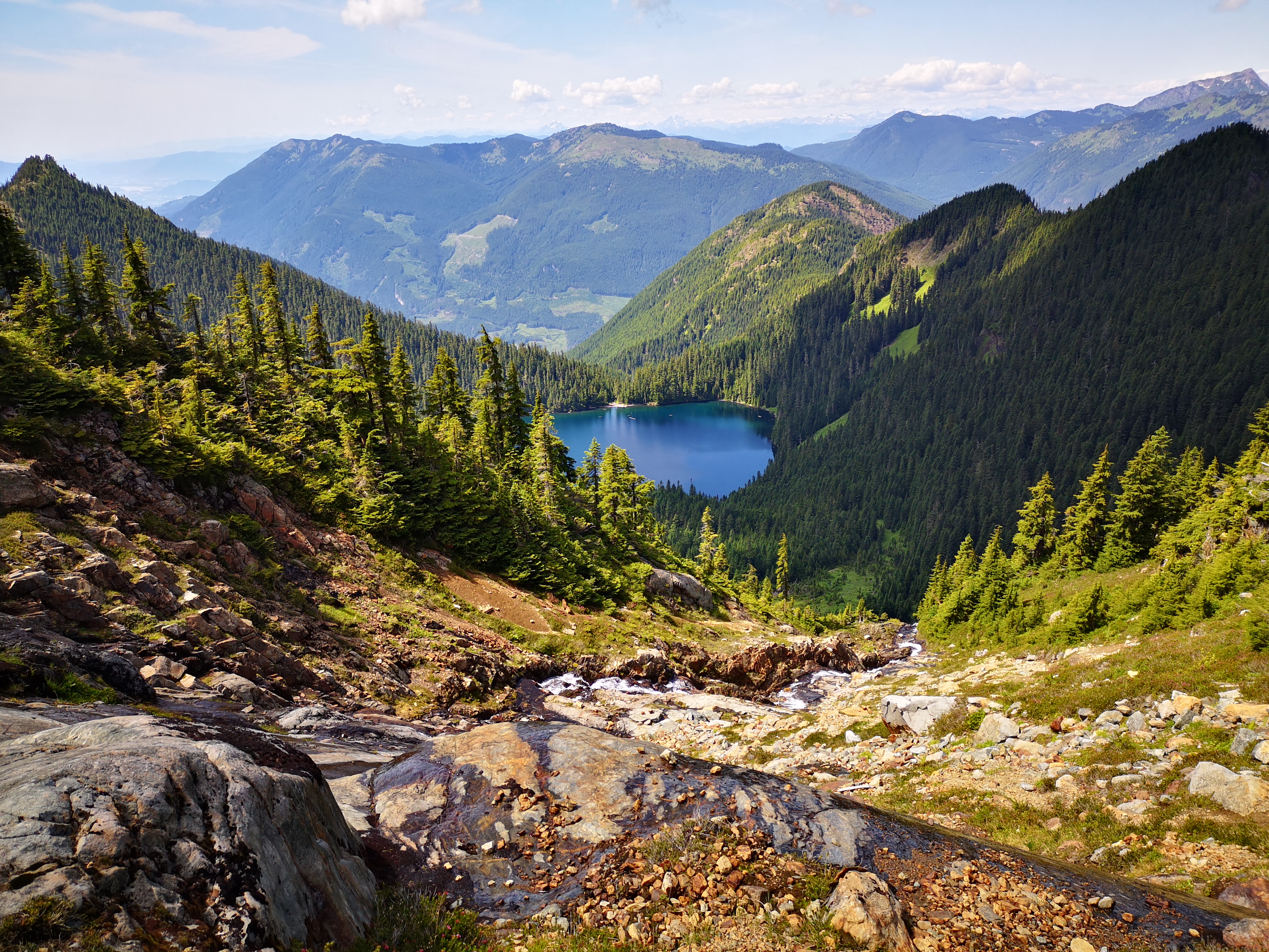
Lower Pierce lake is reached after about 2-3 hours of hiking from the parking lot. It is a lovely sub-alpine lake, with a moody green colour reminiscent of its neighbour and Instagram favourite, Lindeman Lake. There are some great spots for camping in the forest at the edge of the lake, plus a small dock that can apparently be released from its resting place on the shore and piloted across the lake like a boat.
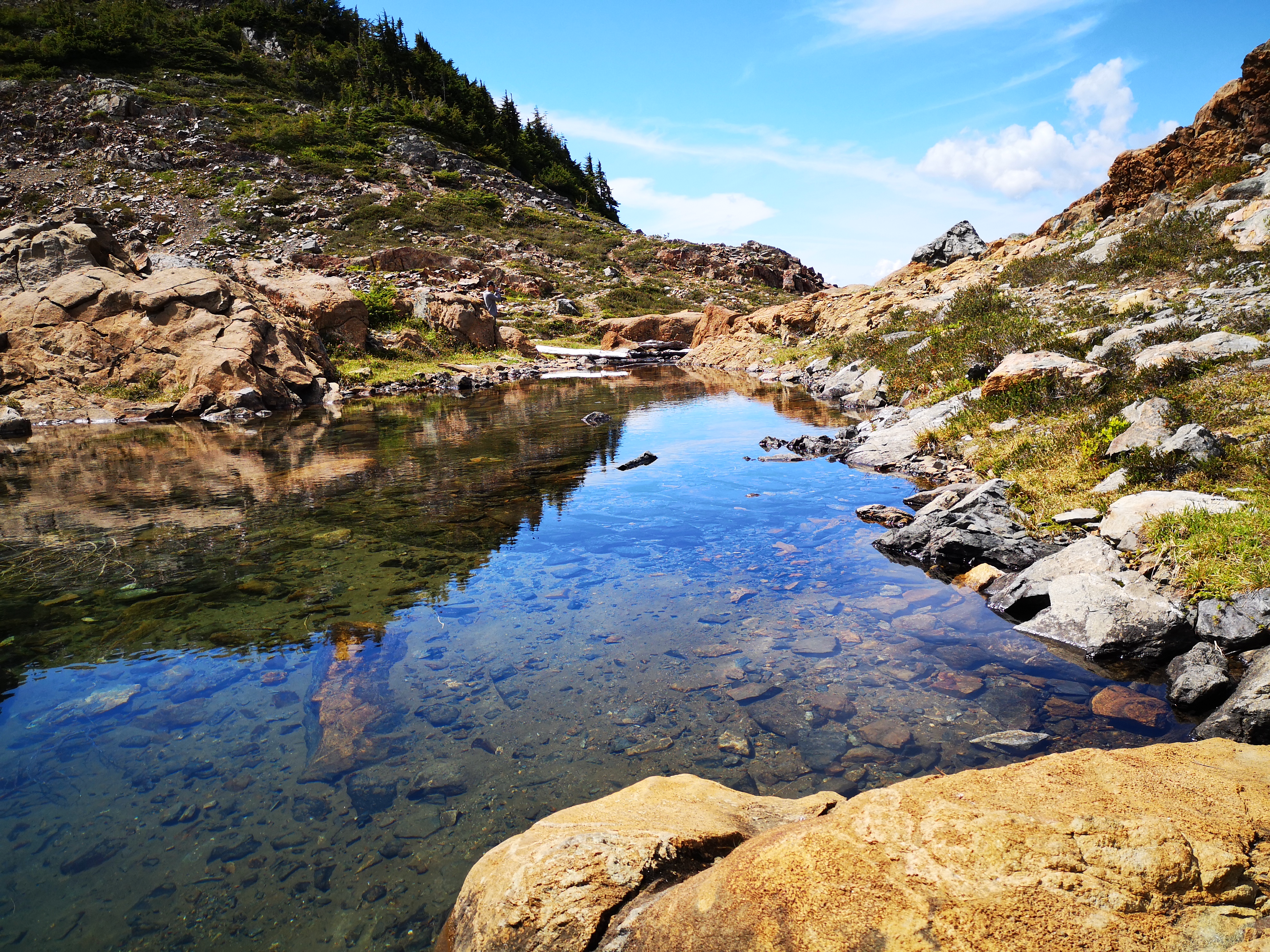
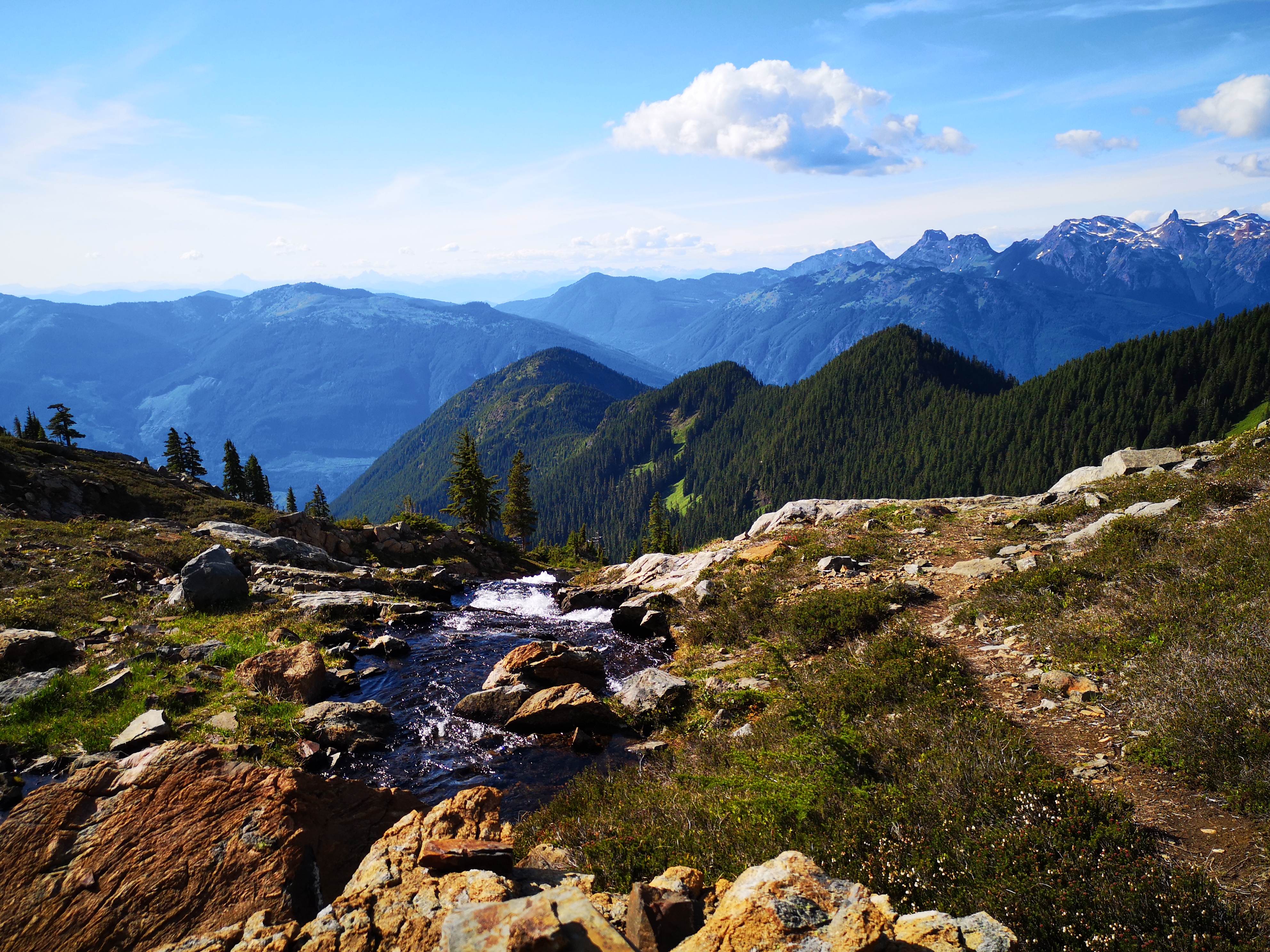
Continuing left around the lake will lead you through a meadow of wildflowers. Then you’ll traverse through flatter, wetter terrain as you approach the walls of the basin that contains Upper Pierce Lake. Here, the trees begin to fall away, replaced by heather, and the rock rises sharply above you. For much of this portion between the lakes, you’re treated to a view of a wide, low waterfall – this is the water running from the upper lake to the lower lake. You’ll cross this creek, then begin to climb the rocks on the left side of the falls. This section is fairly steep (but mostly rock steps instead of the calf-burning incline of the lower portions of the trail), and includes a few moments of easy (class 3) scrambling, with ropes in one or two places to assist.
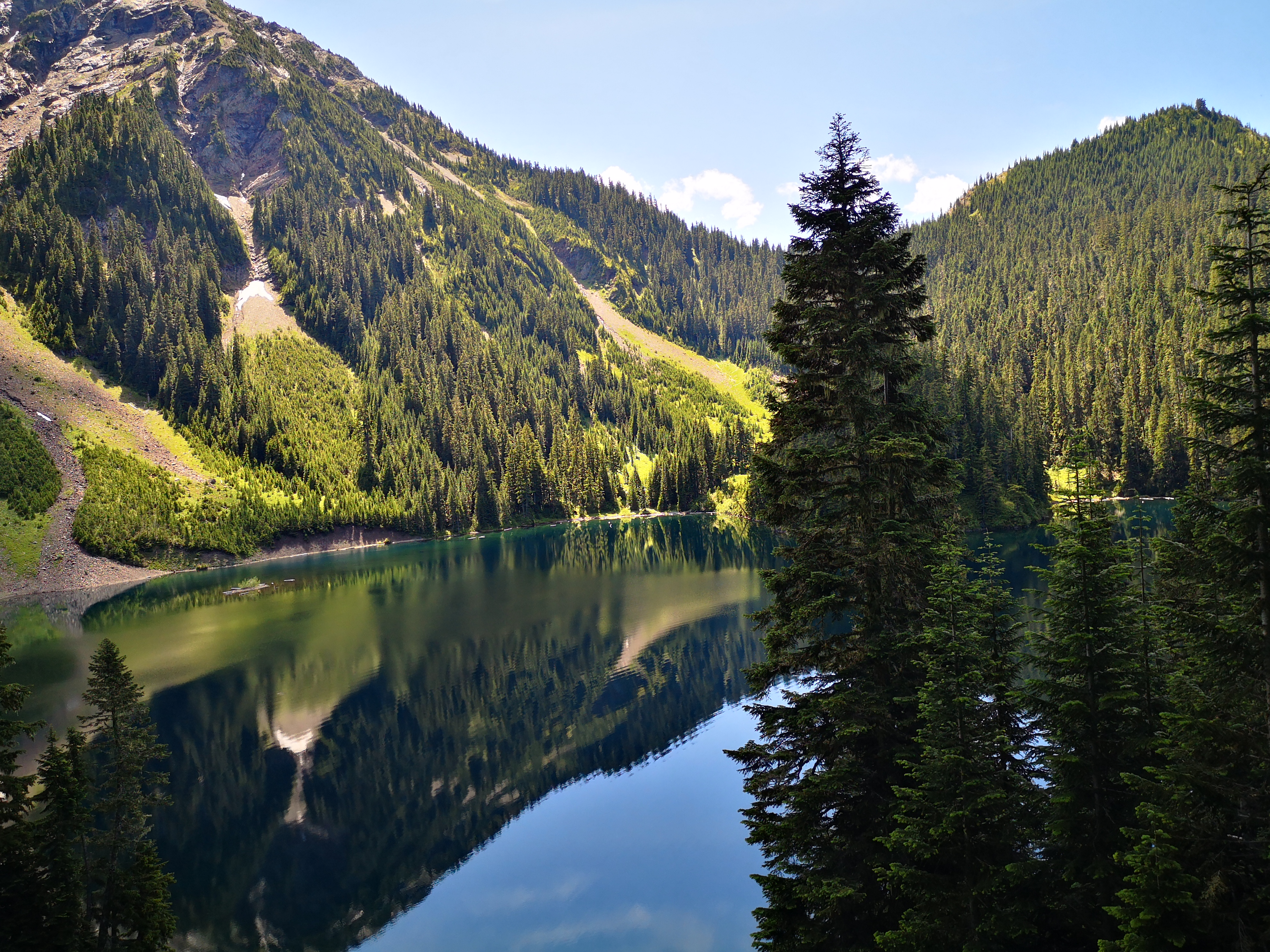
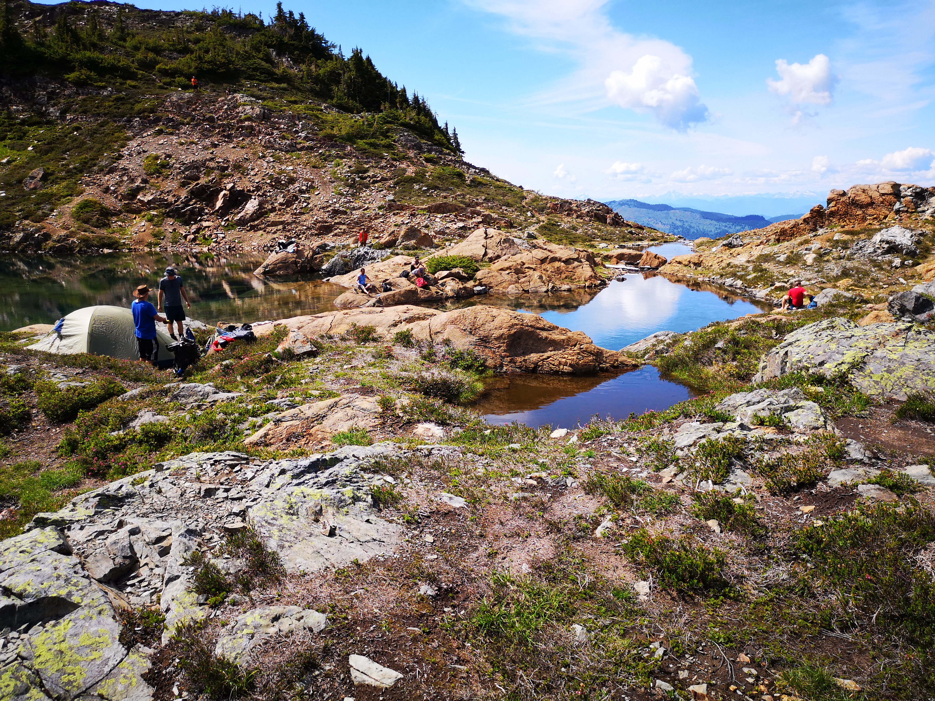
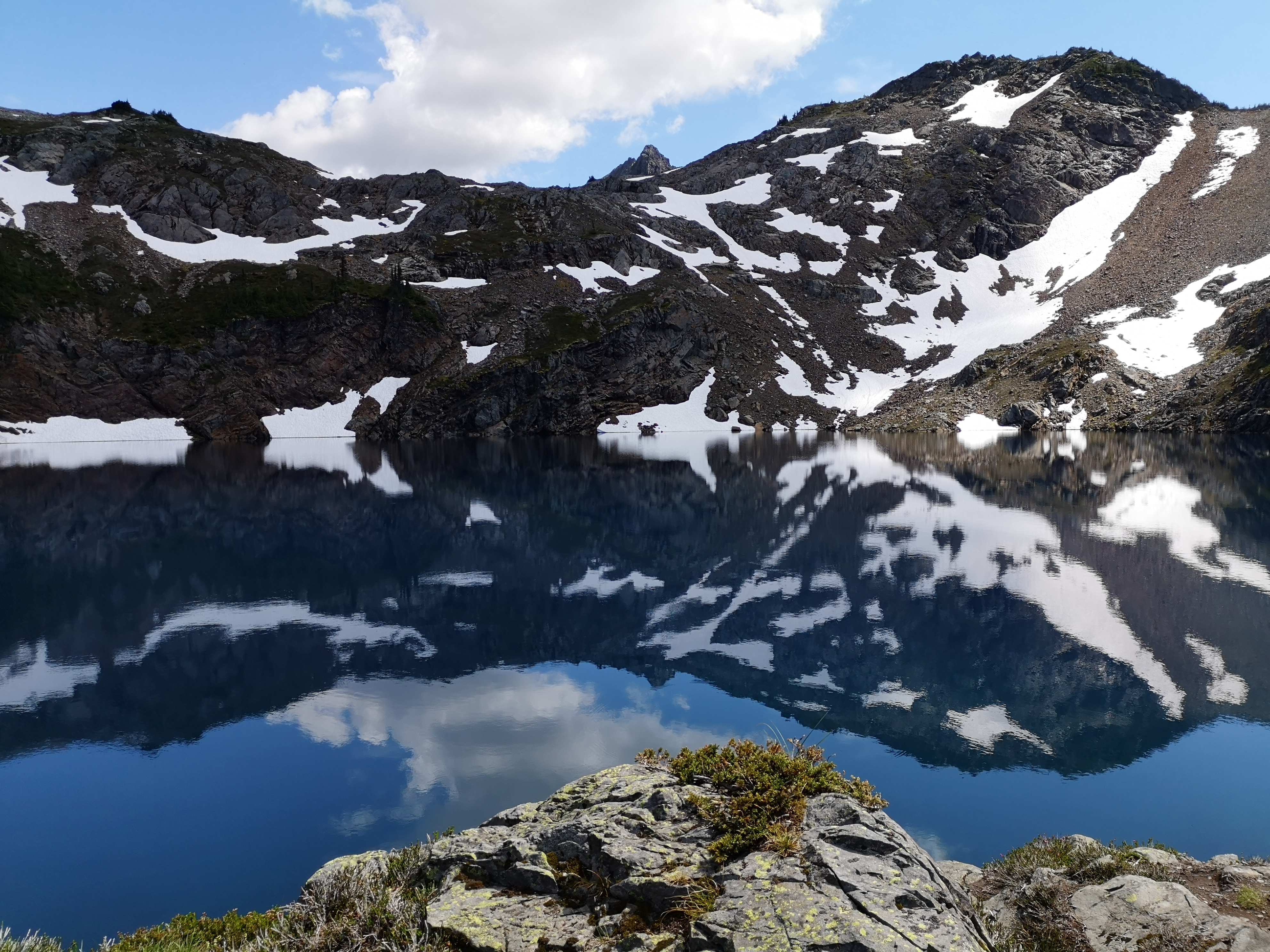
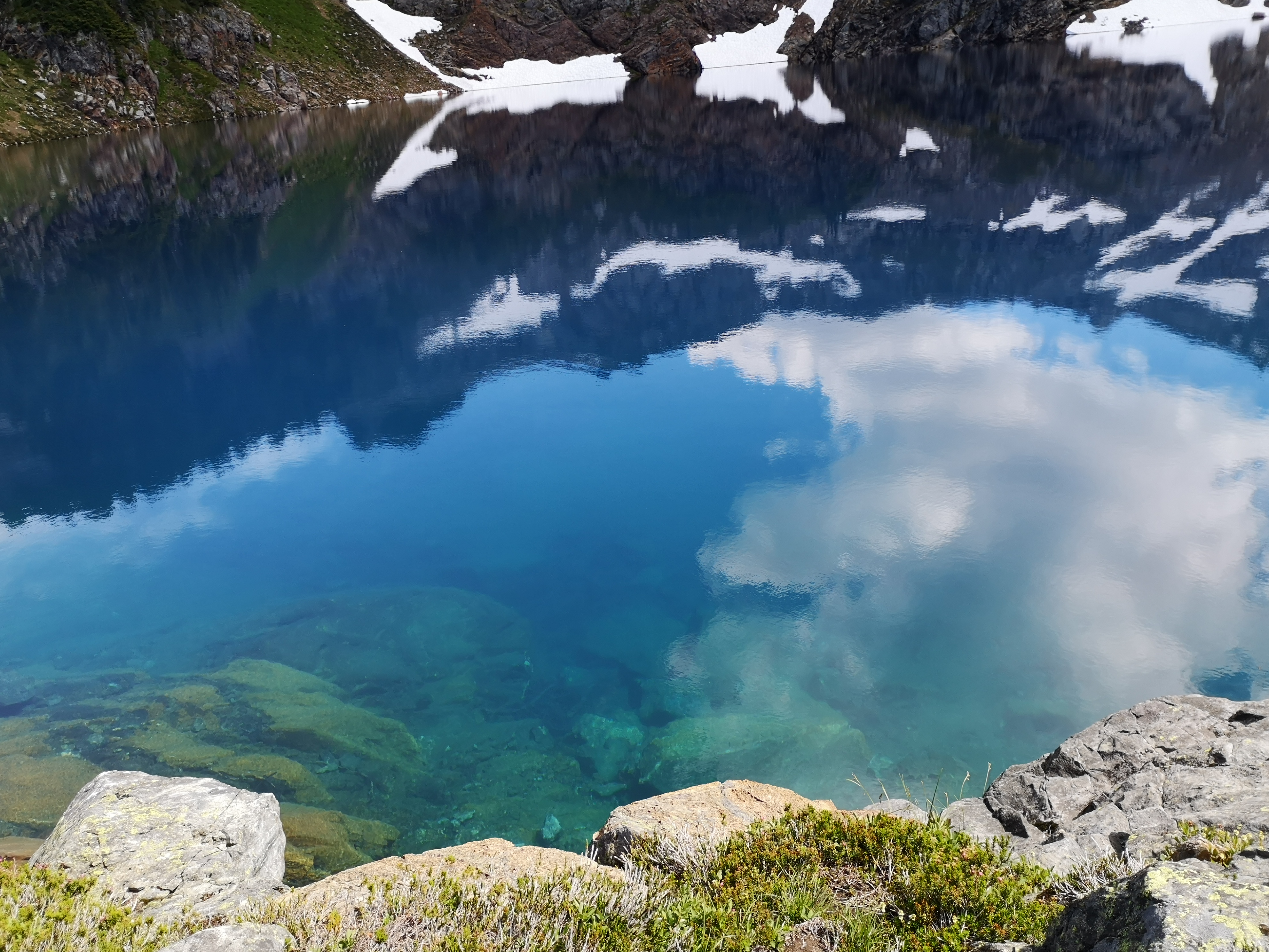
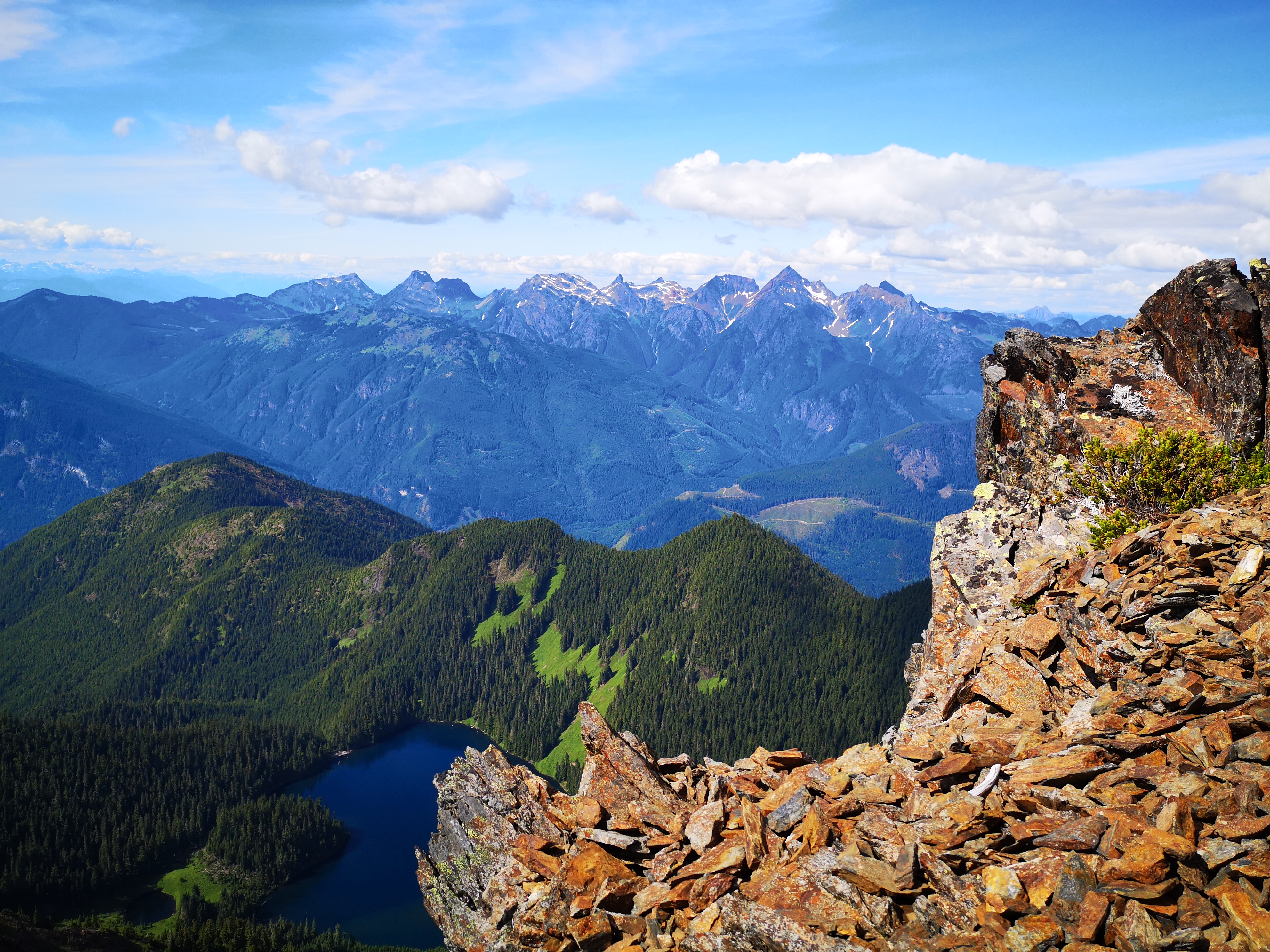
Once you climb to the top of the bowl, Upper Pierce Lake lies in the basin before you. This alpine lake is a unique shade of dark blue, very different from the standard turquoise of other local alpine lakes. The water is ice-cold (it’s fed continually by snow melt), but gorgeous. We heard screams from people brave or foolish enough to jump in, and observed one group just nailing this alpine lake thing with an inflatable raft. This seemed to be the hot camping spot of the weekend, as a number of groups were pitching tents when we arrived. While I don’t envy any groups that had to hike up with overnight bags, Upper Pierce Lake is definitely going on my list as a very desirable camping spot.
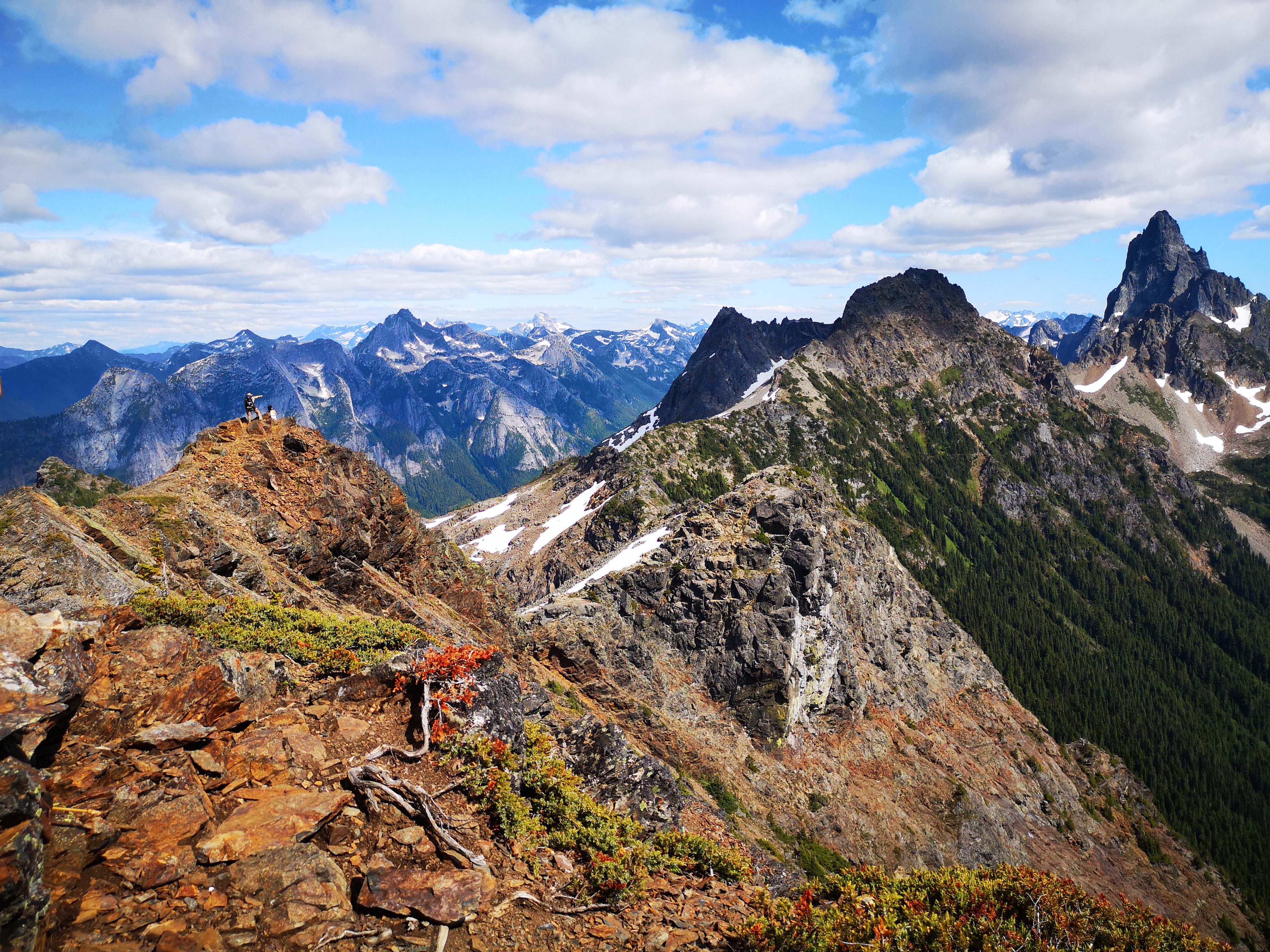
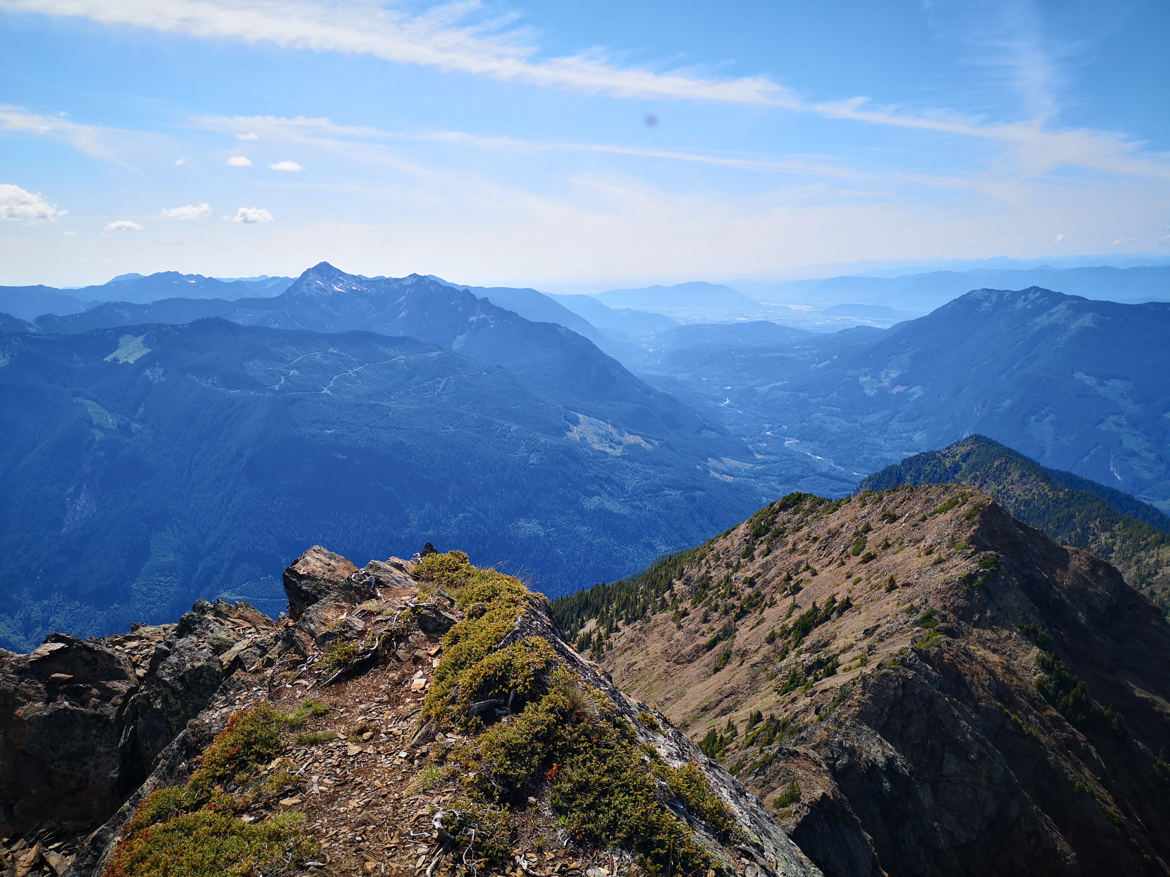
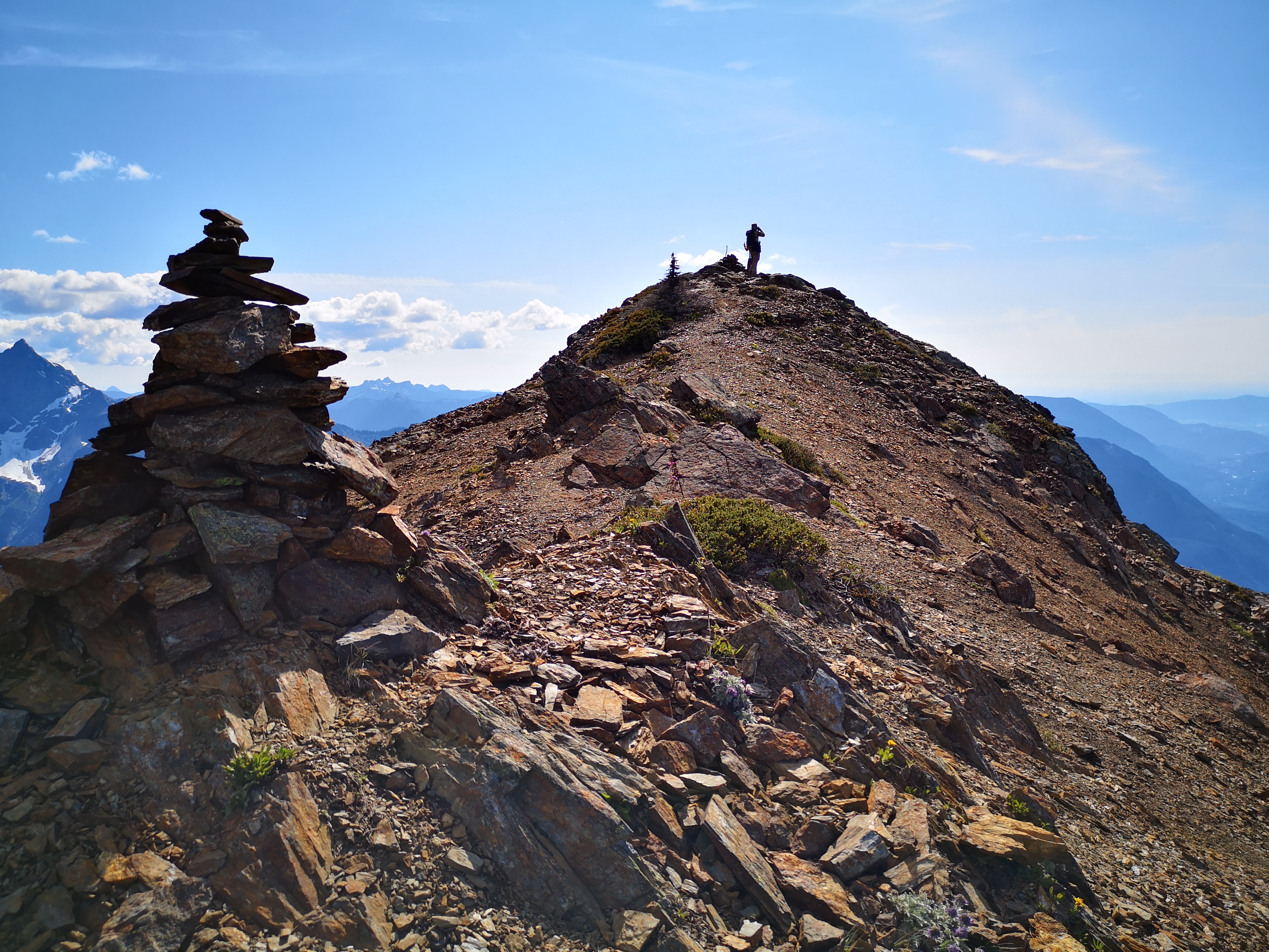
There are two quick summit options from the Upper Lake. Should you be camping, you’d likely have time for both, but our day trip was looking to be long and hard with only one. Taking a left at the lake will lead you up Mt. Pierce itself, a round but worthy-looking peak. Taking a right leads you up the ridge to Mt MacFarlene, our destination. The climb to the summit is about an hour from the lake, and again includes some steep alpine hiking and easy scrambling. I’ll confess that my legs were absolutely on fire at this point, and I took many more breathers than normal. Fortunately, I was surrounded by a very distracting view the whole way. After a few bumps of the ridge, I was standing on the peak.
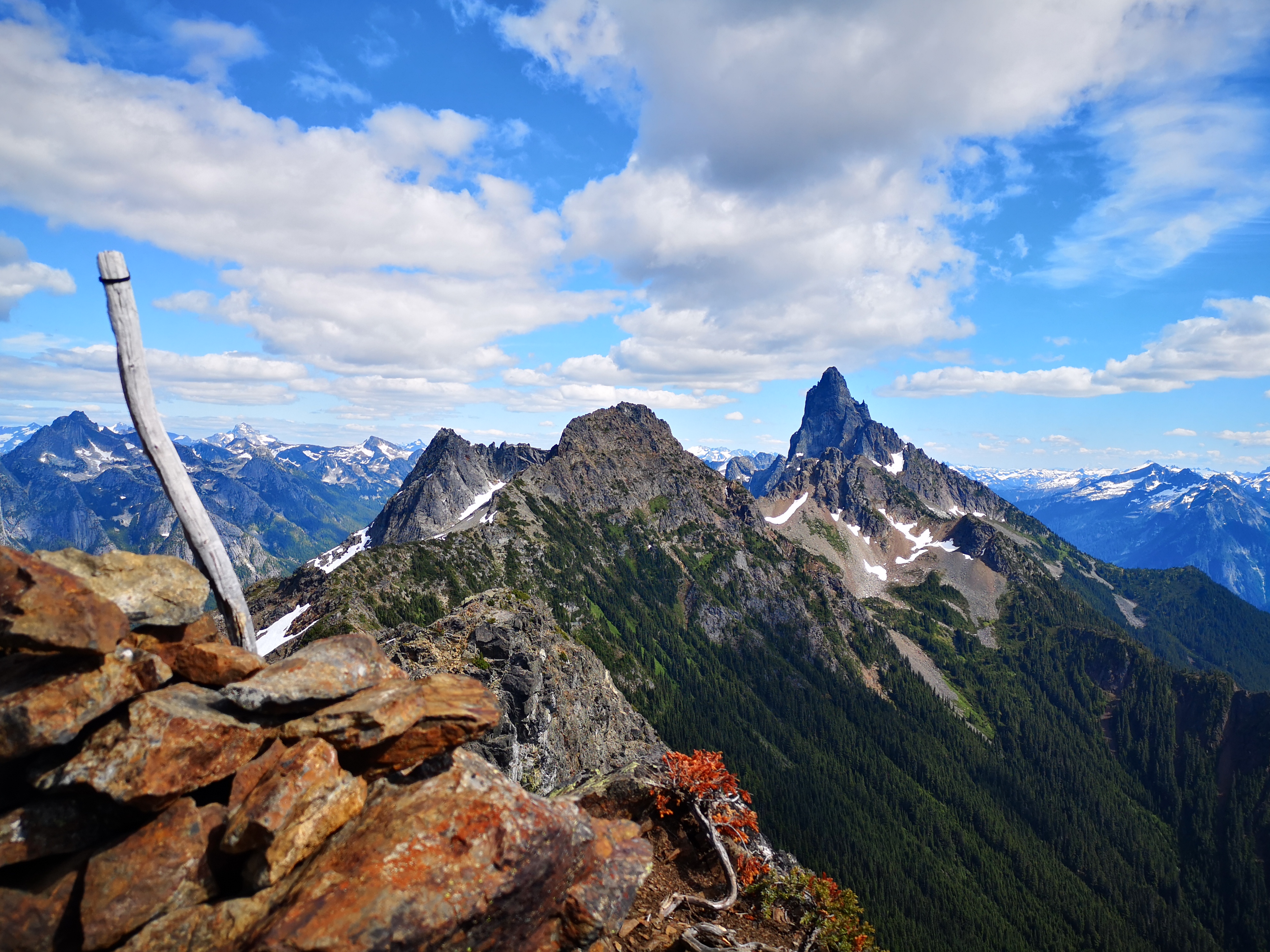
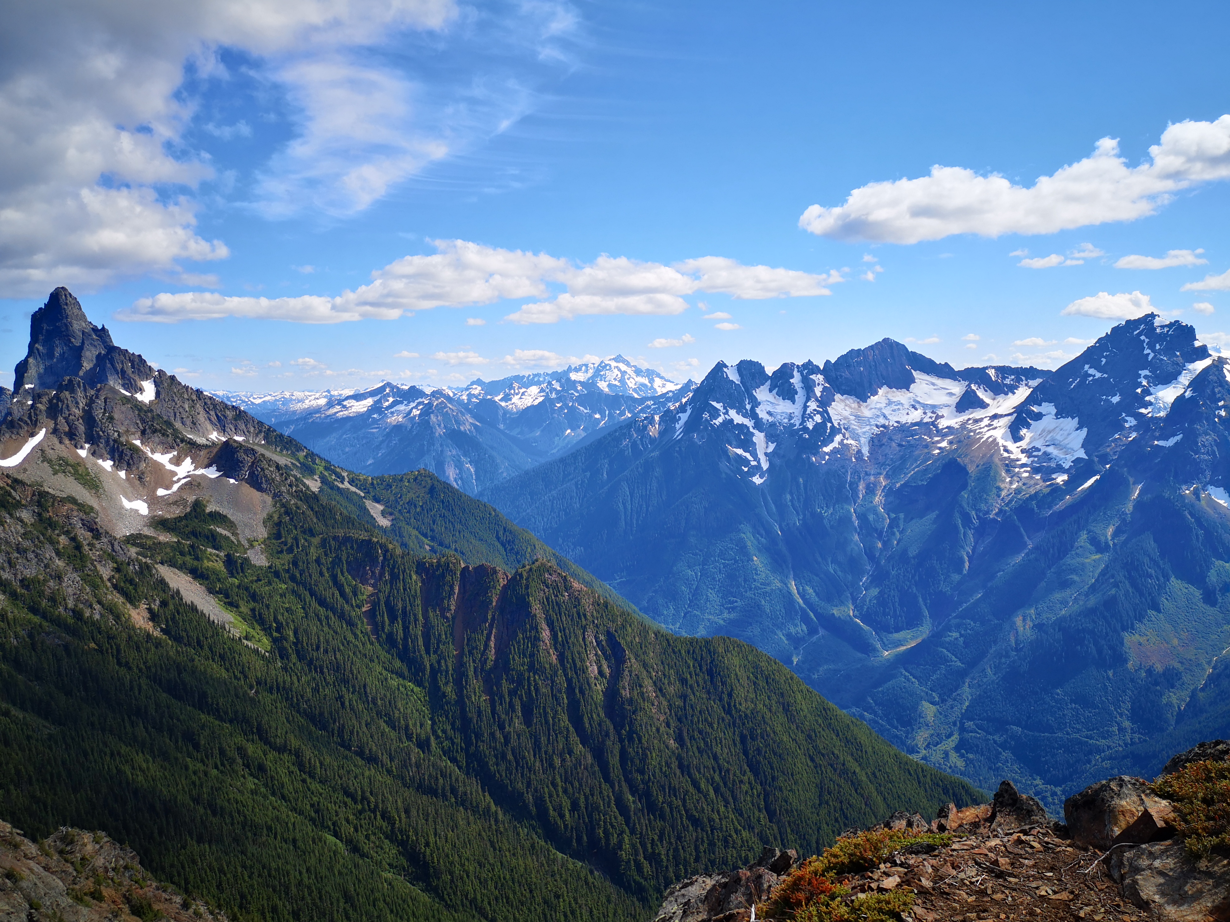
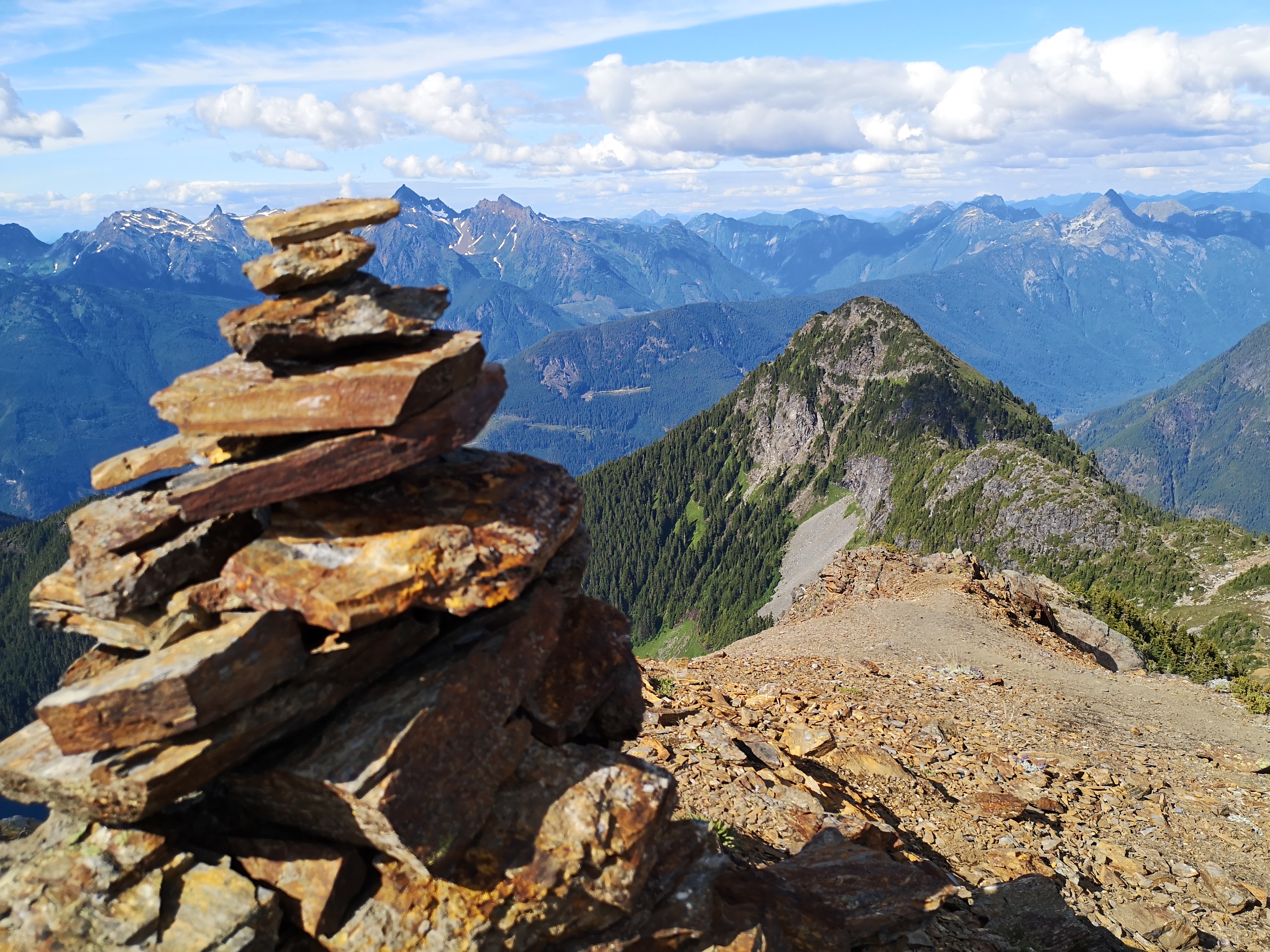
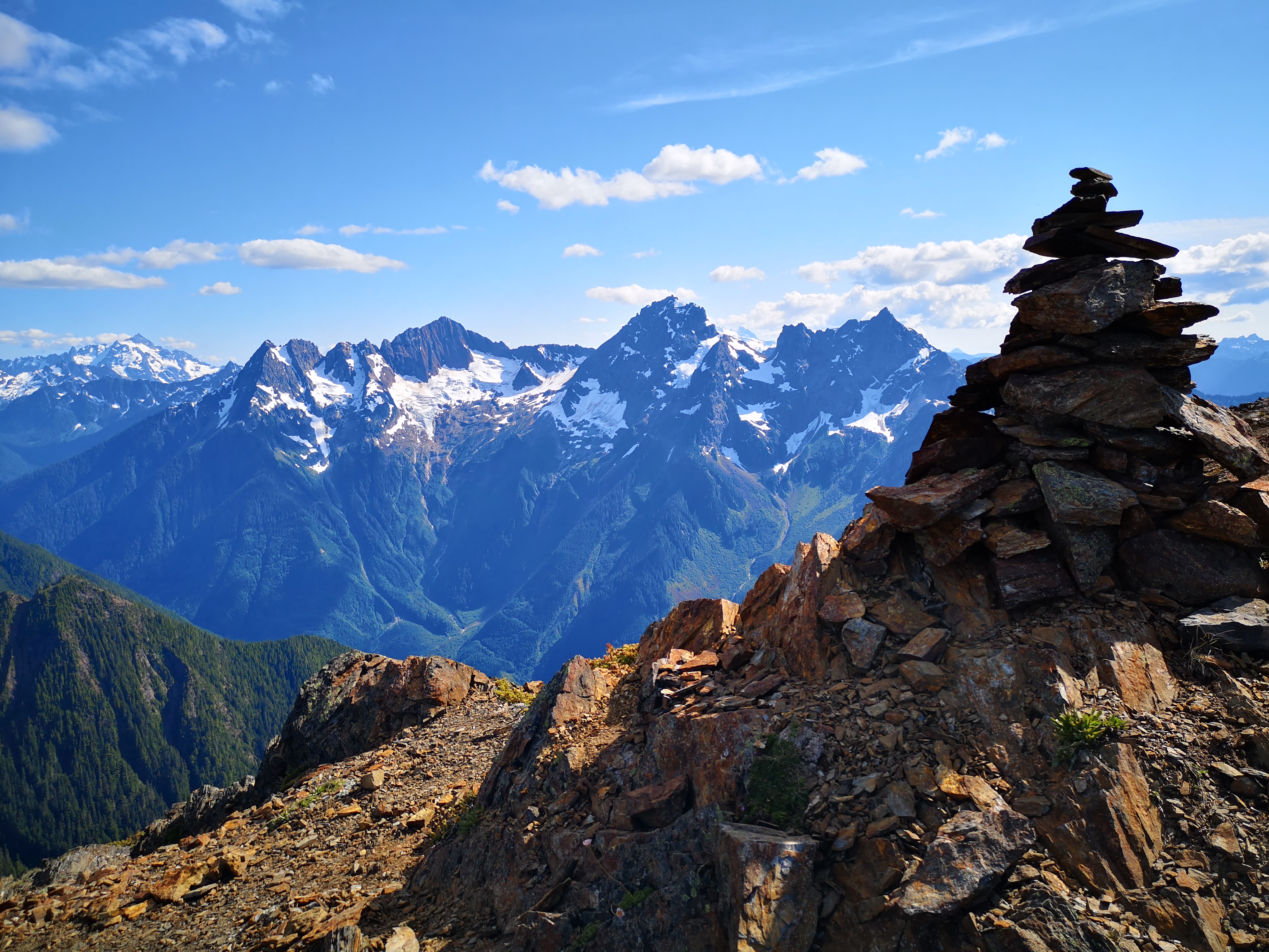
MacFarlene offers a 360 degree view of the surrounding mountains, plus a view of both Upper and Lower Pierce Lake. Chilliwack and the Fraser Valley can also be seen, as well as the bare tops of Baker and its neighbours across the river valley. Mt Pierce sits across from you, back the way you came, then a cluster of viciously sharp peaks and ridges wrapped in glacial ice: Crossover, Slesse, and Larrabee. Behind this range, the edge of the massive American Cascade range is seen, including the Washington behemoth Shuksan.
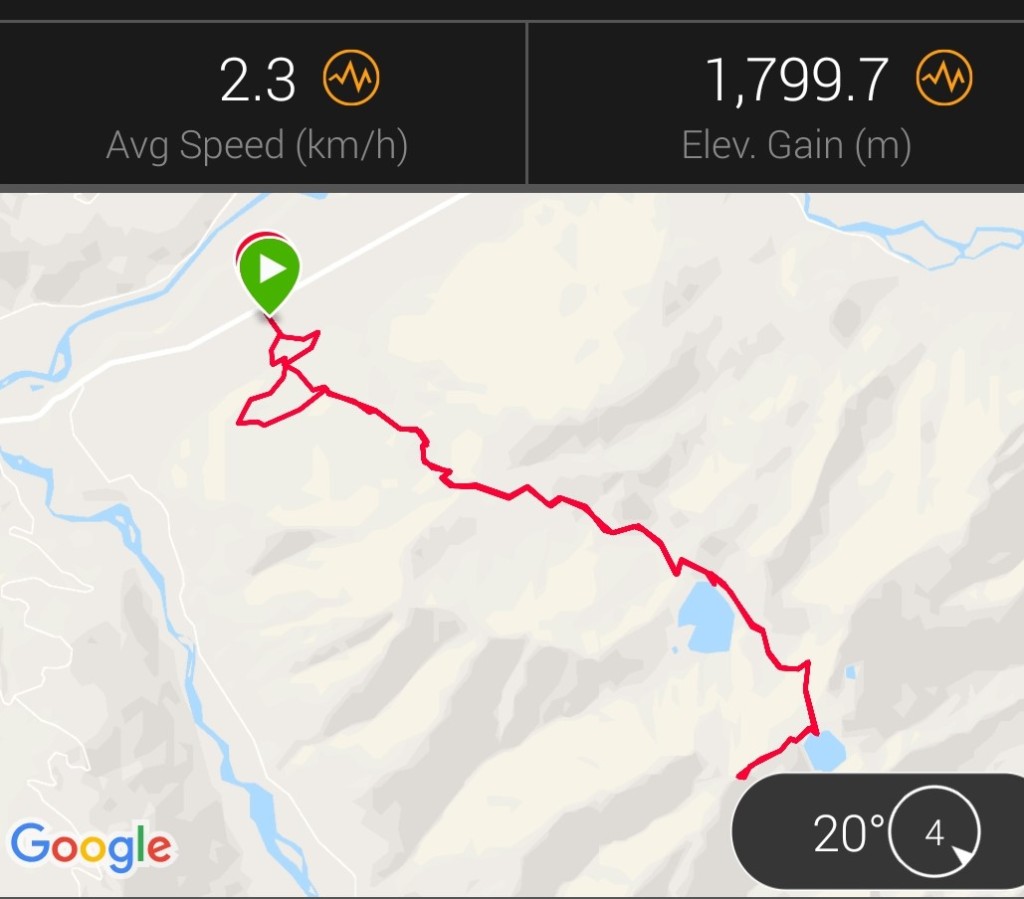
After hanging out on the summit in the hot summer sun, we began our descent. From the top to the Upper Lake, then from the Upper Lake down past the waterfall, was pretty slow going due to the steepness, but once this section was completed, the terrain allowed us to begin moving quickly. A day-trip to MacFarlene is no small thing – the trail covers about 20 km of distance and a whopping 1800 meters of pretty brutal elevation gain; unless you’re in great shape, I’d recommend this as a two-day trip. As our quads were screaming in protest on the descent, we semi-ran the lower portion of the trail to get the discomfort over with quickly (the result of which the next morning were the tightest and most sore quads I’ve had in months). Due to a pretty aggressive pace, we completed the roundtrip in about 8.5 hours; a more realistic pace for this trail would likely be 10-12 hours.
Trail Stats
This trail was completed in mid-July. There was no snow on the trail at this time (only small chunks around the upper lake). The total distance of the trail, including both Upper and Lower Pierce Lakes and the summit of Mt MacFarlene, was 20 km (12.4 miles). The total elevation gain was 1800 m (5906 feet). Allow 10-12 hours for this trip, or consider doing it over two days and camping at one of the lakes.
Despite growing up in the area, I’ve been pretty deficient in hiking in the Chilliwack river valley. Ever heard of Mt MacFarlene? Know any other hidden gems in the area? Let me know in the comments below!

One thought on “A “Rest” Day on Mt MacFarlene”